

Land Use and Settlement Patterns
Land use regulations can guide development away from climate-related risks like sea-level rise and forest fires and lower emissions by encouraging certain building practices or zoning to decrease transportation-related emissions.
Land use and accompanying settlement patterns play a key role in Salt Spring’s long-term ability to lower emissions and adapt to the dramatic changes being brought about by the climate crisis. Scattered settlements in forested areas are more difficult and expensive to protect from forest fires, while roads that serve scattered development are costly and GHG-intensive to build and maintain.
This pattern of development also contributes to a degradation of the ‘ecological services’ provided by healthy ecosystems, such as fire resistance and temperature moderation, and to a cascade of other negative impacts including unnecessary forest loss, compromised water quality, and diminished wildlife. Furthermore, external economic pressures contribute to concerns about affordable housing, which is needed to foster community diversity, social equity, resilience, and self-sufficiency.
Local sea levels are forecast to rise relative to those in the year 2000, with changes accelerating this century. While the degree of rise is uncertain, the most recent study suggests planning for a relative sea-level rise (RSLR) of 0.5 metre by 2055, one metre by 2115 and 2 metres by 2225. Shoreline roads, buildings, and infrastructure on Salt Spring Island will see an increase in the frequency and magnitude of seawater inundation events, saltwater intrusion into potable water supplies, and permanent inundation.
Along with losses to coastal ecosystems, sea-level rise will result in washouts of major roads, affecting emergency services access, interrupt the movement of people and goods, impede tourism, and negatively impact the local economy. A CRD study highlights potential impacts to scores of buildings and pieces of infrastructure, including ferry terminals and water- or wastewater-related infrastructure.
The reality of the climate risks needs to be taken into account today in everything from our Official Community Plan to development decisions by government and individuals. Decisions need to be made now about the location and specifications of infrastructure that will be able to withstand the changes that are underway.
While settlement pattern policies in the current OCP focus on the protection of specific areas and the reduction of future sprawl and greenhouse gas emissions, updating according to the CAP recommendations will be a crucial consideration in the next OCP update.
Land Use News & Events
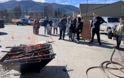
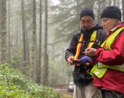
Reducing Wildfire Risks & Biochar: TSS Members Travel to Clearwater, BC, to Talk About Forest Resiliency
Beyond Climate Change: the nuts and bolts of adaptation at the local scale
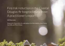
New Report Shows Us How to Reduce Wildfire Risks
What Salt Spring Can Do
A review of the OCP and all associated land-use processes and procedures needs to be made a priority in light of the climate risks faced by our community.
The priorities are:
- Review the OCP and all policies to address climate risk, reduce emissions, address affordable housing, and integrate ecosystem-based planning.
- Revise all land-use processes and procedures, especially as they relate to permitting, to encourage and facilitate climate-smart development.
- Implement plans, policies, and procedures to ensure that our local governments and other agencies prepare Salt Spring for projected risks due to sea-level rise.
Success Stories
- Salt Spring’s land-use policies, described in the OCP, support a shift in the traditional low-density settlement patterns to reduce GHGs and servicing costs.
- Specific goals and policies regarding Climate Change and Energy Efficiency were included in the OCP in 2010 to provide a lens in local land-use decisions.
- While legacy zoning on Salt Spring will allow a few more large lot subdivisions (especially south of the Fulford Valley), OCP policies adopted in 1998 have prohibited the spread of such zoning for over two decades. Instead, the OCP directs most new residential density increases (primarily approved to facilitate the development of affordable and special-needs housing) and key community destinations (such as the library, swimming pool, and large commercial land uses) to existing service areas (e.g., villages) or within walking distance of a transit route, and provides for the voluntary transfer of densities into these areas.
- Since 1998, OCP policies have restricted upzoning of vacant land parcels close to village services to projects for affordable and special-needs housing, rather than market-level multi-unit development. This has given Salt Spring a distinct advantage over many similar communities in the potential to build affordable housing in appropriate areas.
- Due to the efforts of Salt Spring non-profit organizations, the number of social housing units per capita on Salt Spring in 2015 was only slightly lower than in the rest of the Capital Regional District and was much higher than levels in many similar BC communities. Over 100 additional social housing units were close to or under construction in mid-2020.
- The SSI’s Local Trust Committee changed land use regulations recently to permit secondary suites and secondary cottages in climate-smart areas (those not prone to undue climate risks) that support public transit development.
- The CRD produced regional maps that illustrate anticipated sea level rise in select locations and provided details about potential risks and adaptation tools. It recently completed a significant new project about coastal flooding risks and recommended a Flood Construction Level in July 2020.